Wednesday, December 12, 2012

Calama

We had asked Pedro before we left how good the roads were from Ollyangue to Calama.  His answer is one we now get as a pat answer for any road in South America, “the road is good!”  Actually, the road was awful, again miles and miles of wash boards and dust.  We also ran into our familiar friend, the perfunctory stop for road construction.
Road Construction Stop
Waiting for the blasting to end.

Finally we reached pavement and the jarring stopped about 30 miles outside Calama.  I made the comment as we rode into Calama, that it could be any town in west Texas.  Windy, dusty but good gas stations, a mall, numerous stores and all the roads were paved.  There were lots of nice hotels as well.

But we were in for a shock, unlike many west Texas towns, Calama is EXPENSIVE!  The first hotel we stopped at wanted $220 US a night for a room with two beds.  After searching for 2 plus hours we eventually settled on a Hostel (which was more like a hotel) for $187 US, ouch!

During the ride to Calama, my speedometer went out, which is not too bad.  But also so did my cruise.  We were getting ready to do a long stretch of highway, so I ended up tearing out my electrical for the cruise/speedometer to find that a wire had vibrated to the point of breaking.  After a quick strip and fix, it was working again.

That night Chuck and I walked the streets of Calama and found another marching band playing for a dance troop that seemed to be dancing as a benefit, although we could not figure out what for.  It was colorful and I found myself tapping my toe and smiling while the young, middle age and old men and women danced in the plaza.  

Dinner was pretty basic although Chuck did seem to have a problem with his order of papa fritas (French fries).  It took almost a full hour to get them, even though he asked about their status several times.  Some fairly gruff looking biker types came in and because they ordered papa fritas; as well, he eventually got his fries.  J

La Serena
The next day, we were up early and rode through the Atacama desert.  It was about 500 miles, and was I glad to have my cruise control working.  There was nothing but rocks, road, sand and wind.  Not even a lot of traffic.  We eventually made La Serena and again this turned out to be very nice, mostly touristy.  The hostel that Chuck found was very nice and if we weren’t in such a hurry to get to Santiago to get the bikes serviced, it may have been a great place to spend a little time.

We asked for a recommendation for dinner and the proprietor in broken English said three blocks up and to the left, I forget the name.  We followed directions and … nothing!  So I asked.  The soldier in Spanish sorta indicated we had missed it back a block, so we went back, not just one but two.  Then I asked a guy with a guitar who looked like he just got through playing somewhere.  He said, in broken English, oh, you missed it, go back a block.  So we did ... again … nothing, nada, zip!

Eventually we found a café on the side of the road, had dinner and a beer; while watching everyone leave the walking mall.

We were up early again the next morning and off to Santiago.

San Juan


We stopped at this small town called San Juan.  Initially, we were thinking a coke and some cookies, but as we talked to the store owner, we found out they actually had a hotel/hostel.  We were pretty beat up by the road, it was probably 2:00p or 2:30p and we decided to see if there was a room at the inn. 
The Hostel at San Juan

The hotel was very clean and a lot larger than we expected in this tiny little town.  There were absolutely no guests, so we were surprised when the woman said she had only one single room with double beds.  We weren’t equipped to argue with her, so we took it.  It also was fairly expensive at around $60 US.  But we found out later this included dinner and breakfast.  Eventually a whole group of German tourist arrived to take all the rest of the rooms and we found out they had actually given us the room they had reserved for the four tour drivers.  We very much enjoyed our stay at the hostel in San Juan.

The next day we asked the proprietor about directions to Ollanguy (O’ ya wee) the town on the Chilean border.  He said the roads were good and all we had to do was to stay to the right and we would be ok.  These directions lacked clarity and in some cases they were just absolutely wrong.  And the road was a mess.  Lots of rocks, pot holes, sand, salt and again the thing I was learning to love the most, wash boards.  Never, never trust free advice.
My front tire caught the loose sand and spun up into the berm

The distance to Ollangue was probably 40 or 50 miles.  But given the misdirection and the quality of the roads, we didn’t arrive at the border until the afternoon.  This included a ride off I had where I had avoided a rock on a very sandy track and then followed the sand up the side where the bike stayed until Chuck arrived to help me pull it out.  The sand had also pulled of one of my saddlebags that needed a little “adjustment” to make it fit right again.  This route also included a railway crossing but not like most.  The road just led up to the rails and we had to cross the rails without the benefit of any lead up, just bare rails.  This is the MAIN road from Bolivia to Chile????

Ollangue
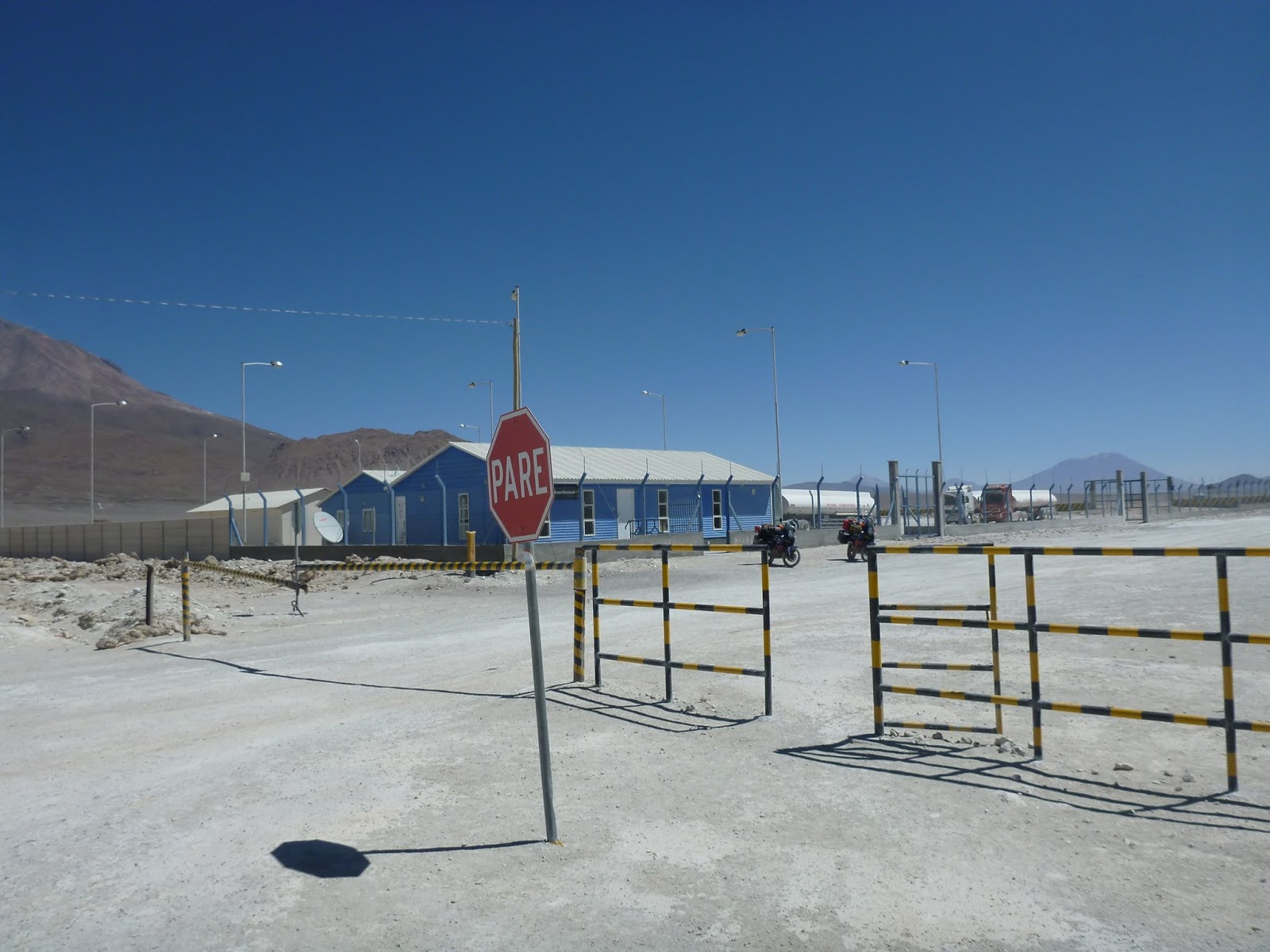
Directions at most border crossings are unclear.  This border was no different.  We looked for the passport processing office (usually the Police office) but could see nothing.  We saw the Aduna for processing vehicles, we drove the a small pedestrian opening and went in.  He asked for our paperwork and was very efficient in processing our vehicles out of Bolivia.  When we asked about processing our passport, he just shook his head and pointed in the direction of the Chile office. 

So the Chilean imagracion is about 3 or 4 miles across the border.  We were thinking he meant the Bolivian passport office was there.  We rode across the divide and of course found no Bolivian office, so we rode back.  This time there was another person in the Aduna office who pointed to a small Bolivian flag, across the tracks sticking up from behind a train.  There we found the police officer who processed our passports.  Nothing is ever easy!

Aduna at the Bolivia side of the border

Policia on the other side of the tracks

Chile was very much more efficient.  After going in the wrong door, I met a receiving agent.  She asked for all our information and processed our passports and motorcycles.  Afterwards we noticed that she had put down Honda’s instead of KTM’s for our motorcycles.  I guess it’s because we bought our bikes at Wild West Honda … hmmm.

We did not have enough gas to make it to the next major town Calama, but we had been told that Ollangue had a gas station.  So we went into town looking for gas.  It turns out the station had closed a long time before, but we were told that a Hostel in town sold gasoline out of the back.  When we found the hostel we were told they would have gas in a hour to come back after lunch.  When we returned we decided to stay for the night.


Gasoline from a barrel

Here we met Pedro.  Pedro was from Santiago and owns a trucking company specializing in the transport of copper ore from Bolivia to Chile to be processed.  One of the nicest guys, one could ever hope to meet.  He let us tie into his cell phone wireless to use the internet and then spent an enormous amount of time giving us advice, directions and descriptions of different places to visit in Chile.  We had dinner and breakfast with Pedro and his crew.

Pedro

We also met a group of five bikers traveling from Brazil.  They were riding BMW’s and an Africa Twin.  It looked like a couple of them had had a get off or two as the bikes were scraped up and pieces missing.  They had ridden from Uyuni to Ollyangue in one day, what had taken us two.  We didn’t speak the same language but we did speak motorcycle!  We took pictures before we left the next morning.

Leoes o' oeste (Lions of the West) with Pedro and us.

On to Calama.


Uyuni

The road from La Paz to Potosi is paved, and not completely filled with Trucks and Buses, so we made pretty good time.  The scenary was spectacular, there were places that made me feel I was looking at that the Grand Canyon in the states.
Figure 4Canyons on the way to Potosi

And we actually found gas along the way.  I marked out a hostel and it took a little time to find it.  When we did, they had an excellent place to park and a room for about $30.  We went and had dinner, and settled in for the night.  Potosi is somewhat a tourist destination, so there was a little walking mall, movie theaters and generally felt very safe.  We had breakfast early and left.  We left town, again without filling up because we could not find a gas station. 

We paid a toll for a brand new road from Potosi to Uyuni.  It had only been open a month, very little traffic, smooth and about of 120 miles of nothing but twisty road….  It was a blast.  But at about 80 miles the reserve light came on and there were NO stations, nothing, nada.  Chuck actually had about 46 miles on his reserve when we finally pulled into Uyuni. 

We ran into some Germans just outside Uyuni and asked if they could follow us to make sure we made it.  They had some extra gas, in water bottles held on back with bungees.  Saftey third!

New friends from Germany

Uyuni
The line of cars at the station in Uyuni was at least a half mile long.  But, we have found out that usually in Bolivia there is a “moto” only line.  I kinda snuck around until one of the attendents finally motioned me in.  And we were now traveling with the five Germans on BMWs, so there were seven of us in total.

I sometimes wonder why others don’t get pissed off because of our cutting in line.  I have never had an issue, if fact many of those in line will get out of their cars to come ask us about our bikes.  This time seven bikes filled up but there were no complaints.  The gas truck just arrived to fill up the tanks in the station and I heard later that some in that line had been waiting since the day before.  We followed the Germans to the hostel they were looking for.  Talking a few weeks later with others who were there, we were told that the gas truck had been days in arriving and they had to find gasoline on the black market from people with drums.  (see later note about Ollangue)

After getting a room at the hostel, we removed our luggage, left it in the room and decided to ride out to Luna Salada (the Salt Hotel).  We had tried to get a reservation but they had indicated that they were fully booked.  But we decided to go anyway, see the hotel and have a beer.  When we got there, they said there had a problem with one of the tours and they had some open rooms.  We went ahead and took a room; how many times do you get to stay in a hotel made of salt. 

Hotel Luna Salada (Salt Hotel)

The road to the hotel was brutal though, entirely wash boarded, some sand but totally beating up the bikes.  It had taken over an hour to travel about 20 miles.  We decided to not go back that night, and just rough it without our luggage.  However, someone was coming out to work and agreed to stop and pick up our luggage.  They cut off the lock on the Hostel room, got our luggage, paid our Hostel bill, bought a new lock and brought our luggage for their cost only.  Nice!

We stayed at the Luna Salada for three days.  The second day we traveled onto the salt, which is the largest lake deposited salt in the world.  NASA usebs the surface of the Salar de Uyuni to calibrate their satellite instruments, as it is much more accurate than the surface of the ocean.  The elevation on our GPS (approximately 12,050 feet) did not vary over ten feet during the entire crossing of about 40 miles. 
The Salt as far as you could see
The outside edge of the salt is actually wet.  It rains on the land surrounding the salt then drains into the salt.  You must be careful not to drive into the wet salt and become stuck. 

We had lunch at the isle de Incahuas.  Pretty much a tourist destination, but still worthwhile.  Chuck had a young admirer, the daughter of one of the workers in the kitchen.  She has apparently never seen a giant with a gray beard.

Chuck's Admirer
She was not camera shy

On the way back, due to the vibration on the salt, the gas can bracket had cracked and broken.  The tanks were lying flat on my side cases.  We pulled it up and held it in place with a bungy.  At the hotel we asked about a welder in town, who could reweld the bracket.   Turns out the hotel had someone employed, who welded.  He came out in front of the hotel, ran a couple wires to the electrical outlet and welded up a fix. 

Welding the gas holder back together

He welded a brace on Chucks as well.  But he ran out of welding rod before he could add a brace to my second side.  He asked for nothing but we gave him what amounted to about $20 each.  I must say, as he started to weld he did not have welding goggles on, and we told him we would not let him weld on our bikes without goggles, so he went and put on his safety gear.

On the second day they moved us to a suite, because the tour that missed the previous day, was now expected.  The suite was huge, a large living room and two bedrooms, one with two doubles and the other with a king size bed.  Unfortunately, we would have gladly traded the upgrade for a few steps closer to the front door and the bikes.  As it was, the suite was literally the furthest room away at 300 steps (Chuck counted).  Carrying our luggage out was a workout at over 12,000 feet elevation.

That's loose salt on the floor

Grotto's outside the rooms along the main hall

As we left the hotel on the final day, we asked about the roads on the opposite side of the salt.  We were told that it was a pretty good road.  Here is some advice, never trust free advice. J 

Here's the map, simple right?

Chuck had programmed an intercept from the previous days track.  So as we got close he took the lead.  I became concerned when we crossed our track but kept going.  We were getting closer and closer to the edge and the wet salt.  What was worse was that Chuck had taken an angle away from the direction we needed to go.  As he stopped to look at his GPS, I caught up and convinced him we needed to back track.  He said he would follow me.  I turned but as we headed back I crossed tracks from vehicles coming from shore.  I stopped to make Chuck aware of the bumps and my bike sank into the salt, getting stuck.  I waved Chuck across the tracks to the other side and he came back and helped me get my bike unstuck.

Stuck in the salt.  It looks like Snow.

We made it to the dirt road on the other side of the salt.  It was about 30 miles to San Juan, but the road was brutal.  Sand, rocks, dust and again, the worst wash boards.   Along with all the questions about which way to go, it took us at least three hours to get to San Juan.

La Paz


After leaving Puno it wasn’t a long ride to Bolivia.  Crossing the border wasn’t difficult either.  We crossed at the major crossing at Desaguadero.  We stood in line for ten minutes to have passports processed then crossed the street to get Aduno for the bikes.  Again, after presenting the paperwork we actually had this time, it was a very quick stamp and we were out of there.  Chuck paid some guy who had official looking slip of paper for what amounted to about 5 bucks for each of us.  I think it was a scam, but the guy raised the gate and let us through.  It might have been worth it just not to have to wait for the official raise the gate.

Looking back into Peru from the Bolivia side.

It has been amazing that highways in the countries we have been through are more like streets.  Streets full of vendors, cabs, buses, trucks and pedestrians.  And streets here through the neighborhood are in much better condition.  Imagine exiting I-45 to go east on Bay Area.  Then throw in vendors on both sides of the exit, like a street festival, with pedestrians walking back and forth, taxi cabs stopping to drop off or pick up, buses who always think they have the right of way and trucks. 
Major Through Street in La Paz

La Paz was no different.  The major artery into La Paz from the south was about 15 miles of these kinds of highways.  We did finally get to a toll road.  It is nice here because most of the toll roads are free for motos.  Once on the toll road traffic pretty much died.  It was nice to have about 15 or 20 miles of little traffic on what was mostly an interstate type freeway.

Regula, one of our roommates in the Santa Marta hostel, had told us about Hotel Rosario, “the best hotel in La Paz!”  For the first time the hotel we were looking for was right where the map said it was.  Only one problem, they were full.  I asked for a recommendation and she pointed out Hotel Sajama a half block away.  We negotiated a price around $30 / night and the room was very nice.  The next day, based on conversations we had, had before we decided to get two single rooms. 

We went back to Hotel Rosario that evening for dinner.  I had a great meal of Llama steak.  It was of game texture but no game taste.  A bottle of wine, with coffee and dessert.  The total was about $90 with tip.  We stayed in La Paz for three nights and had dinner at Hotel Rosario twice.


Llama steak with all the trimmings ... llyummmy

On the last day in La Paz we rode the bikes without the cases up to the start of the “death road” with the intention of riding the death road.  However, when we got there a very thick fog had set in.  It didn’t seem like a good idea to take off through a fog we couldn’t see much more than 15 or 20 feet on a road with two way traffic that was only wide enough for one vehicle.

While in La Paz, we had not had a chance to fill up with gas and we were on reserve.  There aren’t a lot of operating filling stations in Bolivia.  Many have shut down due to lack of gas.  The next morning we stopped at a station as we left La Paz.  The translation was a bit unclear but it became apparent in Bolivia there was subsidized gas for Nationals and a different price 3 to 5 times as much for Tourist. 

What was worse was that there was a paperwork process that involved hand completion and the choice by the operator to even sell to non-Nationals.  After stopping and being refused at the first, then the second station, we began to think that we might be spending the night on the side of the road.  At the third station we got in line and when we got to the pump, the operator refused us service. 

I was determined and just sat there.  The security guy came up and really started to push the operator to give us gas.  Finally, after realizing I wasn’t moving and the line getting longer, and with the help of the security guy, he finally filled us up.  It’s a lesson we are learning.  No doesn’t always mean no.  It’s a hard lesson for us American’s to understand, even when the vendor or the official says no, stand your ground.  Eventually they will give in.


Saturday, November 3, 2012

Puno

Nothing much to report for the trip to Puno.  I was looking forward to seeing Lake Titicaca.  During my high school years I was in the concert choir.  We did a sort of rap song that included geographic locations including Lake Titicaca and of course that became a topic of conversation among us choir members.  So this is for my very good friend Wayne Cowin who was also same the senior Concert Choir.  And yes, I am wearing Harley Davidson rain gear.  Me in front of Lake Titicaca. 


Here’s the bike, nice picture eh!  Good PR for KTM.

One thing I need to mention is we have traveled over 4,000 miles already and have had no trouble with law enforcement.  After all the stories we heard, we had been concerned.  If anything by now we had somewhat become complacent.  Well, when we got near the city of Juliaca a police car pulled in front of us and began wand signaling us over. 

When he came up he asked for our SOAT.  SOAT for you who don’t know is the basic liability insurance.  We had purchased SOAT in Colombia and had read that there was a treaty signed between Colombia, Ecuador, Peru, Bolivia and Chile which allowed spanning coverage between countries. Honestly, the rules are so vague and confusing about insurance, I am not sure what we had, but at that moment it WAS the insurance that covered us in all those countries. 

We had heard from another moto rider that he was shaken down in the exact location for a 110 peruvian, because he couldn’t produce a document.  First we said we were from Texas and couldn’t speak a lick of Spanish, and they could not speak English.  We told them about the agreement and produced our SOAT from Colombia.  They argued it didn’t work for Peru.  Eventually after 30 or 40 minutes of arguing back and forth, I believe we started cutting into the profits and they finally let us go, no charge.

We were again stopped at the edge of Puno, and they wanted the same thing, SOAT.  I got off the bike, told him I didn’t speak Spanish, but “here we go again, with the SOAT.”  He said something that I vaguely understood as “you have already been stopped?” and I said “si!”  He just shook his head and waved us on. 

Again, finding the hotel was a problem.  It wasn’t where it said on Google or Mapsource.  So we ended up stopping at another hotel we passed.  It was a very nice hotel, it even had hot water.  Not all do you know.  But the WiFi left much to be desired. 

Internet service in South America runs generally on Copper.  You can see it strung everywhere.  I imagine even some of the backbone is copper.  Therefore, even if you have a strong wireless signal, everything gets bottlenecked into the main trunk.  I have things to say about global competition and things that countries in South America that we have visited so far will need to change in order to be competitive.  The internet backbone is one of them.

Everything is good.

Friday, November 2, 2012

Machu Picchu

After Abancay we set off towards Machu Picchu.  Actually, you can drive to the town of Ollantaytambo (O’ yay tay tam bo), I know it’s a mouth full but you can’t drive to Machu Picchu.  But on the way we found ourselves dodging a little bit of the scenic roadside debris.  This is not uncommon in this part of the country.


Here is a video of Chuck riding through some of the canyon.  Canyon from Abancay to Ollantaytambo  The roads are like this for hundreds of miles, with very little traffic. 

We also decided to also stop at a little roadside store for a coke and a snack for lunch.  While here I was bitten by these little flies on both elbows.  As of this writing about six days later they still itch.  Worse than any mosquito bites I have ever had!


Again the weather has been so variable.  First starting it was cool, then we ran into rain, and by the time the picture above was taken it was over 90 degrees F.  It is really hard to plan on what to wear.  Chuck bought jacket and pants that are water proof.  I on the other hand, felt we would know what to wear each day.  At this point Chuck made the right choice.  I find I have to stop at least once a day to add or remove rain gear.

We arrived at Ollantaytambo and began the ritual of looking for the Hotel we had planned to stay at.  This has been a theme, the hotels are never where Mapsource or Google says they are.  So Chuck stayed with the bikes while I hiked around the city.  Finally, I found it across towns and down an alley.  That’s our bikes parked at the end of the alley at the Hotel Casa del Mama Valle. 


It was Ollantaytambo’s 125th anniversary.  They had plenty celebration planned, children’s bands, speaches and in the evening a band.  Chuck and I had perfect seats to hear the band and the music was honestly pretty good.  The view however was sometimes blocked by semi-tractor trailers waiting in the middle of the concert crowd to go through a narrow one vehicle wide entrance on the other side.  Imagine that, having a concert in the plaza while traffic is still passing.  Crazy stuff, you would never see in the US.

We bought round trip tickets for the train that night down this road.  Notice all the flowers.  November and December is the prime blossoming time, flowers were blossoming everywhere.

So we traveled by train from Ollantaytambo to Machu Picchu City, which is also known as Aguas Caliente because of the hot spring.  The train ride was very picturesque, but only if you sat on the side away from the train station.  The other side was mostly looking at the side of the wall. 

In Aguas Caliente, we expected to find not much in the way of a city.  Were we wrong?  The city was bustling, lots of shops, a market square and plenty of restaurants and bars.  Everyone you past had a hawker trying to bring you in.  Chuck met a hawker who had a deal for a hostel.  We followed her to her place and it was perfect for the night and the price was right, about $30.

We woke up the next morning BEFORE the crack of dawn and were down at the bus station before 5:30a.  Chuck had read that only the first 400 of the day got to visit the temple of the high priest and we wanted to do that.  We rode the bus up to the entrance gate.  You can hike up but it is about 3.5 km, and we saw some who did walk up, and I am glad we rode the bus.

So here is where things got a little off.  We got in line with the collective and began to notice they all had tickets to get into Machu Picchu.


We began to ask ourselves if we needed tickets, could we buy tickets here?  Finally I  asked a gate agent at the top of the stairs.  She told me we needed tickets and could not buy tickets there, we had to go back down.  Or, maybe one of the guides could help us.  I actually asked the guide closest to the us sort in the left center of the picture.  She called, got our information and ordered some tickets to be delivered, but it took an extra hour and half.  Chuck was pretty bummed that he had missed the requirement for tickets to be pre-purchased. 

Ultimately it all worked out for the best.  I don’t think we were prepared to make the trek to the temple of the high priest.  It was a very long climb up a narrow path to the top of Wayna Picchu, the peak overlooking Machu Picchu.  The path and stairs we climbed to the overlook on the other end of Machu Piccu was work enough.  Here is the standard picture of Machu Piccu with me in it! J  Wayna Picchu is the prominent peak in the middle and the Temple is near the top, although it is difficult to make out.  The Wayna Picchu trail runs along the ridge where the shadow is.

Here is Ruth, our guide, at the same point.

There were lots of pictures taken but I won’t post them here.  It will have to wait until I have a better connection.  But here is one I found quite funny.  At first on the camera it looked perfect.  The Llama had been munching on the grass all the time I walked by.  When I turned she raised her head and I took the shot.  When I finally looked at it on the computer I noticed an added character on the lower right.  I really don’t know what Chuck was taking a picture of, but may be that’s why the Llama raised her head J


After traveling with the guide for about 2 ½ hours and hearing about Machu Picchu, it was time for us to leave. 

So, here is a piece of advice if you are planning on visiting Machu Picchu, you must take the train.  Ollantaytambo is the furthest you can drive.  You will be tempted to buy a round trip ticket at the Ollantaytambo station, BUT DON’T!  Buy only the one way.  When you decide to leave from the other end, at Aquas Caliente, you can buy the return ticket then.  The line to purchase there is non-existent. 

Chuck and I wanted to leave Aguas Calientes a little early since we were finished at Machu Picchu.  And even though the early return train was empty and the later train we were scheduled to take was practically full, they would not exchange tickets.  “Sorry sir, my system only allows me to sell tickets.  I must have twenty four hour advanced notice to exchange.”  Argggh!  We sat around, drank beer, ate pizza, slept on the park bench and basically became derelict.  I guess it could have been worse.

So here are some observations, from sitting around.  These folks are industrious.  I hear there is plenty of laziness but from watching I didn’t see much.  I guess if the salary is structured correctly you will get what you need.  I suspect they get paid for every load they deliver. 

Here a person pulls a full trolley of drinks up to perspective stores, bars or restaurants.  We calculated these things must weigh around 300 lbs and it is up a very steep incline. 

These indigenous woman carry the loads on their back. I don’t know how much they weigh but they are large.  We watched as she made at least 3 trips up and back this long incline carrying these bags.

Latter, Chuck was talking with an engineer from Korea managing a power project in the area.  The engineer said getting locals to work was difficult, everything seemed to be “manjana”!  Here is a definition I took from the Urban dictionary: “To take it slow; relax. Hey man, where were you? It's noon and we had an appointment at 9 o'clock sharp! Manjana, manjana!”  I guess, we should not expect to bring western (or eastern for that matter) cultural expectations to another culture and expect them to work.  Getting paid on an hourly basis in this society apparently leads to unexpected results.

We finally got back to Casa del Mama, spent the night and the next day we were up and on our way to Puno, Peru.  

Sunday, October 28, 2012

Nasca / Puquio / Abancay

NASCA
One of the things on our list to visit on this trip was the Nasca Lines.  We had decided to forgo the cheaper solution of paying for a climb to the top of the viewing tower and actually forked over enough for the flying tour.  

Our Flight Plan

The tower from the air

I decided to try out my video capability, let's put it this way, the Amateur film makers have nothing to fear from my untapped talent.  But, just to give you a feel for what we experienced here is a view of the "Parrot", also is a picture of the route we took from Nasca to visit the lines.  All in all it was about a 35 minute flight and cost $110.00 US.  Chuck was a little woozy from the flight so we took a break after we landed to let him get back his land legs.

PUQUIO
When we finished the tour of the Nasca lines, it was only around noon, so we took off for the next town towards Machu Picchu; Puquio, about 150 kms.  It is just incredible to me the rise and fall as you cross west to east across Peru.  In those 150kms we climbed to around 13,900 feet and back down again to just over 10,000 feet in Puquio.  We found a nice little hotel on the plaza and parked the bikes.  Asked the proprietor for a restaurant recommendation and he gave us a recommendation.  It was really good food and the courtyard was a relaxing change from much of what we have experienced. 

Below is the church viewed from the hotel in the town square.  The bell tower on the left was actually rang by young parishioners who either had very good ear protection or came away with an extreme headache.


After dinner we turned in early, got up late, had deysayuno a the same restaurant, got packed and we were on our way again.  It was a little exciting getting down from the parking garage, that emptied into a street with busy traffic.  Many of the hotels / hostels have parking but it may be a small enclave in the hotel, which usually means steps and gutters to overcome.  The owner of this hotel had obviously experienced this before because he had blocks and boards specifically sized to overcome the obstacles.  However it was a good 20 degree incline with no place to put your feet.  But no incidents, not even a bobble.

ABANCAY
As we left Puquio it was obvious there was going to be rain, in fact there was even hail.  I stopped and put my rain gear on, and I was glad I did.  But once I have my rain gear on, it is really hard to take pictures.  The road actually began to accumulate hail and turned white like snow.  But it wasn't slick and we had no problems with traction or slipping.  

I did stop and take some pictures as we reached one of the high points, 14,960 feet.  There aren't even mountain tops in Colorado that high.  We reached this height several times and the lowest temperature we experienced was 38.8 deg as indicated on the bike. 


These guys were very suspicious of this gringo on a motorcycle taking pictures of their charges.

On to Machu Picchu!